AR in Sustainable Urban Planning: Building Smarter, Greener Cities
What’s new in AR this month? In August 2025, Tampa Bay became the latest city to integrate AR into its sustainable planning initiatives, allowing citizens to explore flood protection systems, resilient infrastructure, and future zoning options directly through augmented overlays. At the same time, a consortium of European cities announced a pilot program using AR-enabled digital twins to model heat islands and renewable energy adoption. These updates highlight a clear trend: AR is no longer an experimental tool—it’s becoming an essential instrument for climate-conscious, sustainable urban design.
Why Sustainable Urban Planning Needs AR
Urban planning is facing unprecedented challenges. Rising sea levels, extreme weather events, rapid population growth, and the demand for greener infrastructure require planners to think beyond traditional blueprints and static 3D models. Augmented reality (AR) bridges this gap by overlaying interactive simulations on physical spaces—enabling planners, architects, and citizens to see the impacts of design decisions before they are built. This makes sustainable outcomes more achievable, transparent, and inclusive.
Key Applications of AR in Sustainable Urban Planning
1. Climate Resilience and Risk Management
AR allows city officials and residents to visualize the consequences of climate change. Flood zones, rising sea levels, and storm surge projections can be overlaid on actual streets, making risks tangible. Instead of reading reports, communities can walk through potential future scenarios, building empathy and urgency for sustainable interventions.
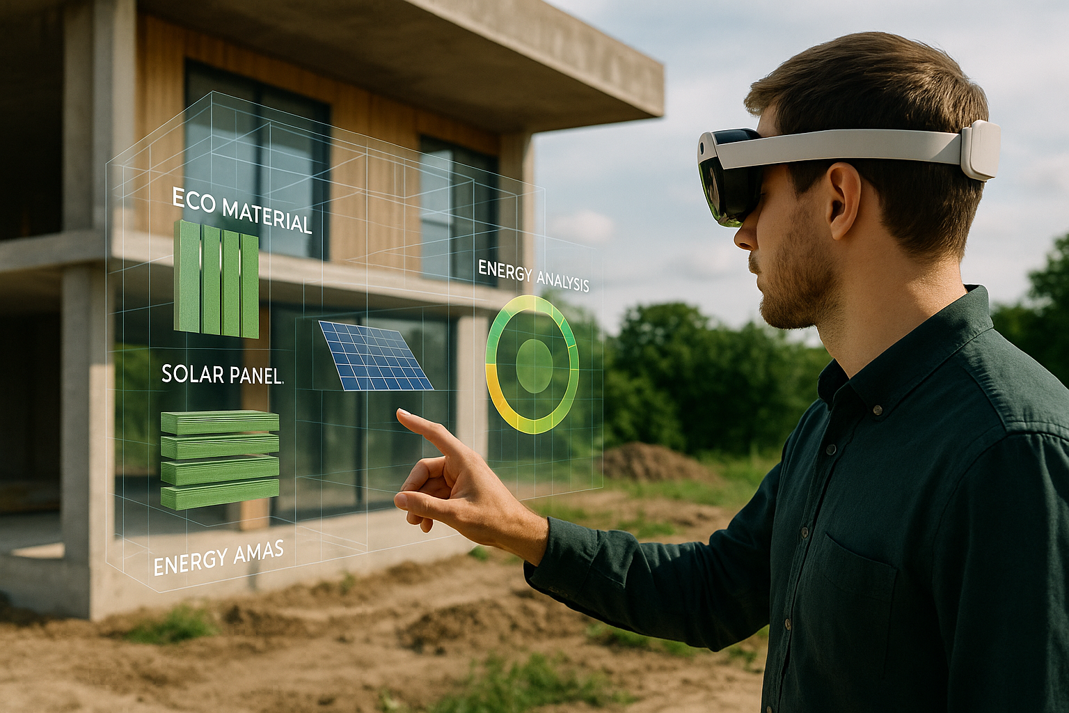
2. Energy and Resource Optimization
AR tools simulate energy flows and resource usage at the neighborhood scale. By projecting solar potential on rooftops or wind flow patterns across districts, planners can identify optimal renewable energy sites. This spatial visualization supports decarbonization strategies and aligns design choices with net-zero goals.
3. Sustainable Mobility and Transportation
Transportation contributes significantly to urban emissions. AR supports sustainable transit planning by simulating new bike lanes, bus corridors, or pedestrian plazas in real-world environments. Citizens can instantly see how streets might look with fewer cars and more green space, fostering buy-in for bold mobility reforms.
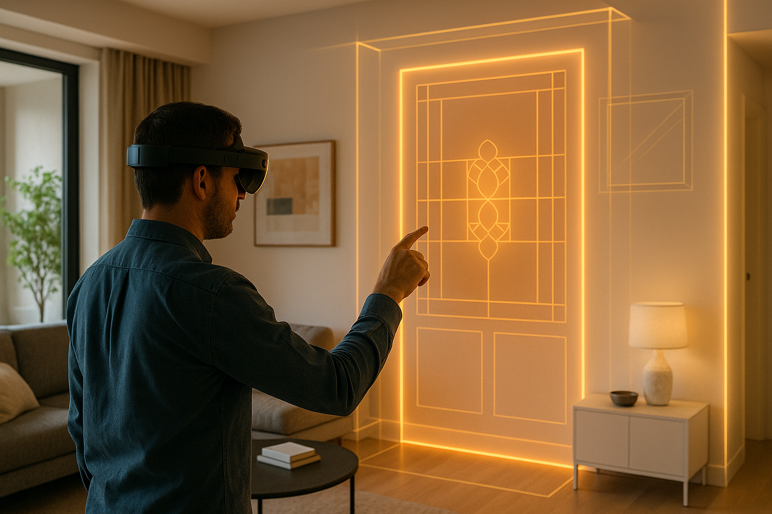
4. Green Infrastructure Visualization
From urban forests to permeable pavements, sustainable solutions often suffer from being “invisible” until built. AR solves this by showing tree canopy growth, rain garden performance, or cooling effects of green roofs projected on existing structures—helping stakeholders grasp long-term benefits at a glance.
5. Participatory Community Engagement
AR democratizes planning. Instead of deciphering technical maps, citizens can use smartphones or AR kiosks to view proposed projects on-site. Want to know how a new park will change your neighborhood? AR shows you. Want to understand the shade provided by a future tree canopy? AR visualizes it instantly. This transparency builds trust and strengthens civic participation.
Real-World Use Cases
- Tampa Bay, USA: Residents explore AR overlays of elevated flood defenses and resilient housing, contributing feedback on proposed measures.
- Amsterdam, Netherlands: AR-enabled digital twins simulate bike lane expansions and renewable microgrids, balancing historic preservation with sustainability goals.
- Singapore: Virtual Singapore integrates AR into smart urban management, projecting solar access, ventilation flows, and greenery impacts directly onto city streets.
- Barcelona, Spain: AR participatory apps let citizens preview pedestrianization projects in real time, increasing acceptance of car-free zones.
Quick Facts & Data Insights
- By 2026, 40% of major cities will adopt AR for climate resilience planning.
- Cities using AR in public engagement report a 42% increase in citizen participation compared to traditional surveys.
- Digital twin integration with AR has reduced planning review cycles by 26% in European pilot programs.
Benefits of AR for Sustainability
- Transparency: Citizens understand environmental trade-offs visually, not just textually.
- Efficiency: Planners test multiple design options rapidly without costly physical prototypes.
- Equity: Visual simulations improve inclusivity for non-experts, empowering more diverse communities to contribute.
- Resilience: Climate adaptation measures are easier to communicate and fund when the risks are visually compelling.
Challenges to Adoption
- Hardware barriers: Not all residents have access to AR-ready devices—cities must provide kiosks or community hubs.
- Data privacy: AR requires geolocation and sensor data, which must be managed securely.
- Over-complexity: Poorly designed AR experiences can overwhelm rather than clarify. Minimalism and clarity are essential.
- Integration with legacy systems: Many cities rely on outdated planning tools that need bridging layers to connect with AR platforms.
Best Practices for AR in Sustainable Urban Planning
- Keep visuals simple: Use color-coded overlays and animations for clarity.
- Design for outdoor use: Ensure visibility under varied lighting and weather conditions.
- Support accessibility: Provide audio cues and simplified overlays for inclusivity.
- Encourage feedback loops: Integrate AR projects with channels for public input—like surveys or virtual town halls.
Future Outlook: AR for Climate-Resilient Cities
Looking toward 2030, AR will become inseparable from sustainable urban planning. Cities will deploy AR integrated with IoT sensor networks, showing real-time air quality, energy usage, and mobility flows directly onto physical environments. Emergency services will rely on AR overlays for evacuation routes during floods or fires, while planners will use live AR data to optimize heat island reduction and energy efficiency strategies.
By blending AR with digital twins, AI, and citizen science, the next decade of urban planning will be more participatory, more resilient, and more sustainable than ever before.
Key Takeaways
- AR in sustainable urban planning transforms abstract models into tangible, immersive experiences.
- It empowers both planners and citizens to make informed, climate-conscious decisions.
- The technology reduces planning time, increases engagement, and supports climate resilience strategies.
- By 2030, AR will be central to how cities design, adapt, and thrive in a changing world.