What’s new in AR this month? In September 2025, global cities took another step toward the future of smart design. Singapore’s Urban Redevelopment Authority launched the Smart City Sandbox, which uses AR for zoning visualization, while Helsinki implemented AR layers for community feedback in climate-responsive projects. These moves highlight how Augmented Reality (AR) is becoming an indispensable tool for visualizing, planning, and optimizing the urban environments of tomorrow.
The Role of AR in Modern Urban Planning
Urban planning shapes how people live, move, and interact in cities. For decades, planners relied on 2D maps and static 3D models—tools that limited communication with stakeholders and citizens. AR revolutionizes this process by overlaying real-time, data-rich models of future developments on the actual environment. This gives everyone—from city officials to residents—a shared understanding of how infrastructure and policy changes will impact daily life.
How AR Enhances Decision-Making and Collaboration
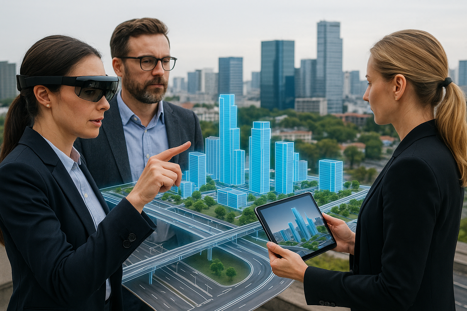
With AR, city planners, architects, and citizens can visualize proposed projects in real scale before construction begins. This reduces uncertainty, increases transparency, and fosters collaboration between experts and the public. Complex issues like traffic management, green infrastructure, or disaster preparedness can now be analyzed visually in real-world contexts.
Applications in Real Cities
- Traffic Management: AR overlays simulate vehicle and pedestrian flow, helping planners optimize intersections and public transport systems.
- Environmental Resilience: Planners visualize flood zones, solar exposure, and tree canopy coverage directly on the terrain to improve climate adaptation strategies.
- Public Participation: Citizens use AR apps to explore proposed parks, bike lanes, and housing projects and provide instant feedback, strengthening community involvement.
AR in Smart City Development
1. Urban Design and Zoning
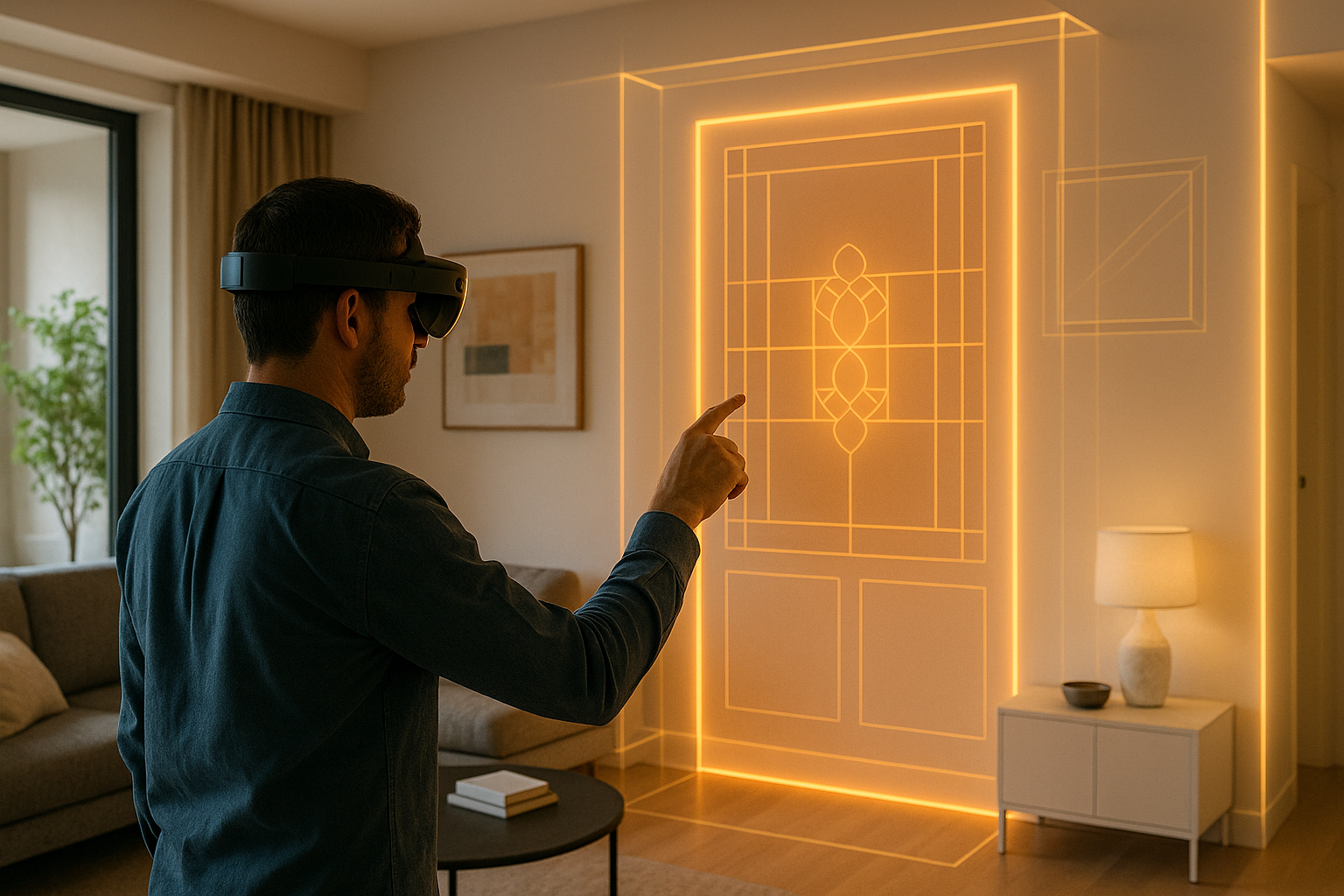
AR allows zoning and building envelopes to be projected directly onto their real-world locations. This ensures architectural harmony, prevents overdevelopment, and supports sustainable growth. Urban designers can quickly identify potential conflicts between infrastructure and the built environment before a single foundation is poured.
2. Infrastructure Coordination
Underground utilities, roads, and smart sensors are visualized in AR for better integration. Engineers and planners can “see through” the ground to plan future maintenance or avoid collisions between systems—reducing costs and preventing major disruptions.
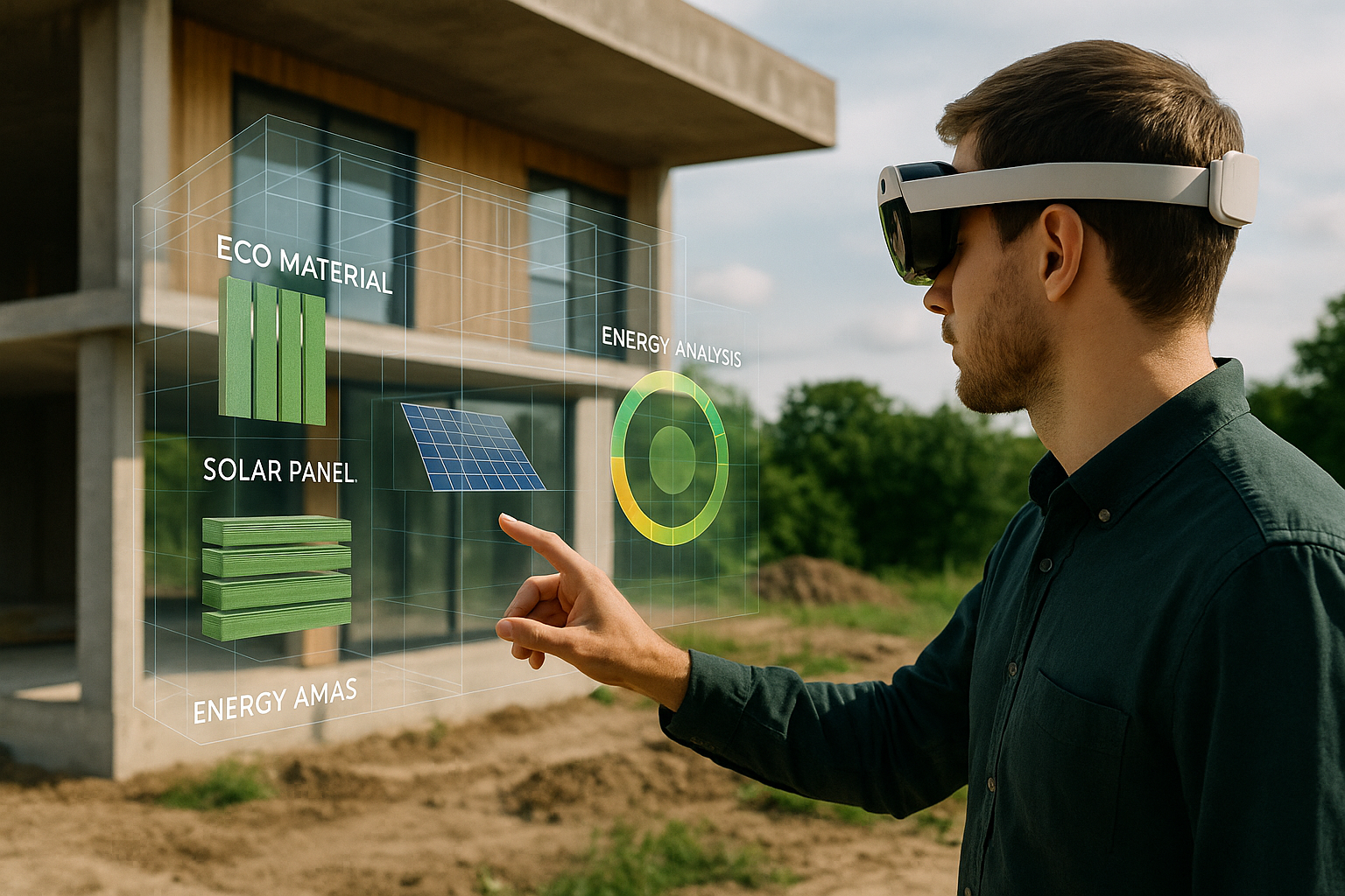
3. Green and Sustainable Design
AR tools now link directly with environmental data. For instance, sunlight and wind simulations overlaid on urban spaces help optimize building orientation and green space distribution. This integration fosters healthier, more energy-efficient cities.
AR in Citizen Engagement and Governance
Transparency is key to modern governance. AR makes urban development accessible to everyone. Instead of reviewing complex blueprints, citizens can explore life-sized models of new transit lines or neighborhood redesigns. This immersive engagement builds trust and reduces resistance to change, turning residents into active contributors to city planning.
How Architects and Developers Benefit
- Faster Approvals: City councils can review AR-enhanced proposals on-site, expediting decision-making.
- Improved Accuracy: Real-time geospatial overlays minimize design errors and ensure compliance with safety standards.
- Cost Reduction: Virtual pre-visualization reduces rework during construction and saves resources.
Case Studies
1. Singapore – Smart City Sandbox
Planners visualize new transport corridors and green spaces using AR models overlaid on physical landscapes. This approach improved inter-agency coordination and reduced design revision time by 22%.
2. Helsinki – AR for Climate Planning
Helsinki’s AR platform integrates citizen feedback directly into spatial plans, allowing users to view heat island data or tree coverage in AR before policies are finalized.
3. Dubai – The AR Masterplan Initiative
Dubai’s Smart City team uses AR to preview new districts before construction begins, allowing rapid evaluation of density, solar exposure, and skyline aesthetics—all in real context.
Challenges and Considerations
- Hardware Accessibility: Professional AR devices remain costly, slowing widespread adoption among small planning teams.
- Data Management: AR requires continuous updates of city datasets, 3D scans, and GIS layers to remain accurate.
- Privacy and Ethics: Publicly accessible AR data must comply with local privacy regulations to protect citizens and businesses.
The Future: Toward Spatially Intelligent Cities
The convergence of AR, AI, and IoT will create self-optimizing cities where physical and digital systems co-exist seamlessly. AR interfaces will allow citizens to view live traffic, air quality, and energy data in their neighborhoods. Architects will simulate entire districts, and policymakers will test climate resilience scenarios interactively before implementation. These “spatially intelligent” cities will bridge design, sustainability, and participation in one unified framework.
Key Takeaways
- AR is revolutionizing urban planning by merging visualization, data, and public participation into one immersive experience.
- Smart city integration enables data-driven, sustainable design that reduces waste and improves livability.
- Future-ready cities will rely on AR and AI collaboration to adapt in real time to human and environmental needs.