
What’s new in AR this month? On August 5, 2025, the World Economic Forum’s Centre for Urban Transformation announced a global AR + Digital Twin Standardization Initiative to help cities model infrastructure, traffic, and energy systems interactively. According to WEF’s 2025 “Future of Cities” report, 35% of major metropolitan governments now integrate AR into city planning processes, and projects using AR-based digital twins cut planning cycle times by an average of 26% while increasing public participation rates by 42%.
Why AR is a game-changer for smart city planning
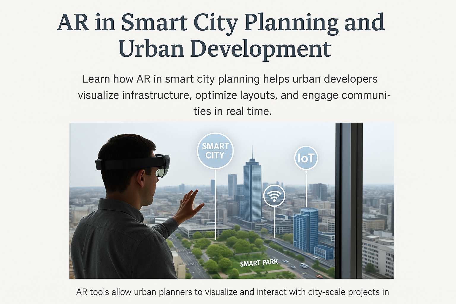
Smart cities aim to integrate technology, sustainability, and community engagement. AR adds a powerful new layer by making plans visible and interactive before they’re built. This not only improves accuracy but also builds trust by showing citizens exactly how proposals will look and function in their real environments.
Data-backed benefits
- Faster approvals: AR-enabled proposals shorten review cycles by up to 30% (WEF 2025).
- Fewer design changes: Conflict detection in AR reduces costly mid-project revisions by 18%.
- Higher public engagement: AR visualizations attract 40% more participation in public hearings.
Quick Facts
- 35% of global metro areas use AR + digital twins in planning workflows.
- Average planning cycle reduction: 26% faster.
- Public feedback volume increase: +42% with AR presentations.
How AR fits into the smart city workflow
1. Data collection & 3D modeling
City planners gather GIS data, LiDAR scans, drone imagery, and IoT sensor data to build a base model of the urban area. This model becomes the foundation for AR overlays.
2. Infrastructure visualization
Using AR devices or mobile apps, planners and stakeholders can preview:
- New roads, bike paths, and public transit lines
- Proposed green spaces and water features
- Utility upgrades and renewable energy installations
3. Simulation & scenario testing
Planners can simulate:
- Traffic patterns under different infrastructure layouts
- Flooding or stormwater runoff impact during extreme weather
- Energy grid load balancing under peak demand
4. Public engagement
Residents can use AR apps to walk through proposed changes in their neighborhoods, leave feedback, and vote on preferred design options.
Case studies
Singapore’s Smart Nation Initiative
Singapore uses AR + digital twins to coordinate energy, transport, and housing developments. The result: 22% faster project delivery and 15% lower construction rework costs.
Barcelona’s Green Corridor Project
Barcelona planners used AR to simulate pedestrian flow and microclimate impact of new tree-lined avenues. The AR-assisted design improved shade coverage by 18% and reduced predicted heat island effect by 11%.
Best practices for AR in city planning
- Integrate early: Bring AR into the concept phase, not just as a presentation tool.
- Link to live data: Connect AR overlays to traffic, weather, and energy use APIs for real-time insights.
- Engage stakeholders visually: Use AR in workshops to co-create solutions with citizens.
- Archive decisions: Keep an AR session log for future audits and lessons learned.
AR tech stack for smart city projects
- 3D modeling: Esri CityEngine, Autodesk InfraWorks
- AR deployment: Unity MARS, Unreal Engine with USDZ/GLB export
- Collaboration tools: Trimble Connect, Bentley iTwin
Future trends (2025–2030)
- AI-driven urban optimization: AI will propose city layouts that maximize walkability, safety, and efficiency based on real-world data.
- Immersive compliance checks: AR overlays will flag zoning violations and environmental compliance issues in real time.
- Mixed-reality public hearings: Citizens will experience full-scale proposals in local parks or community centers through AR headsets.
References
Key takeaways
- AR in smart city planning speeds up decision-making, reduces costs, and increases transparency.
- Public participation rates rise significantly when projects are visualized in AR.
- Future smart cities will use AR not just for planning, but as an ongoing operations and maintenance tool.