AR in site analysis is transforming how architects approach planning and land development. Traditional methods like physical surveys, zoning maps, and aerial photos can’t match the real-time spatial insight augmented reality now provides. By overlaying zoning data, terrain features, and environmental context directly onto the physical site, AR empowers faster, more informed planning decisions.
With platforms like AUGmentecture, architects and planners can walk through proposed projects while viewing height limits, setbacks, and landscape interactions in real space—turning abstract data into intuitive understanding. Here’s how AR is redefining the earliest (and most critical) phase of the architectural process.
Why AR in Site Analysis Matters from Day One
Site analysis is the foundation for every successful project. But even with topographic surveys, drone imaging, and GIS tools, many decisions are still made from a desktop or drawing board—disconnected from the actual terrain.
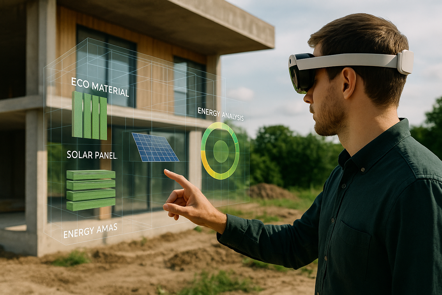
By using AR in site analysis, architects can:
- Superimpose 3D models over real land features
- View solar paths, slope gradients, or water runoff
- Validate zoning overlays and legal constraints on-site
These insights help avoid costly mistakes and unlock new design possibilities tailored to the land itself.
Benefits of AR in Site Planning and Feasibility Studies
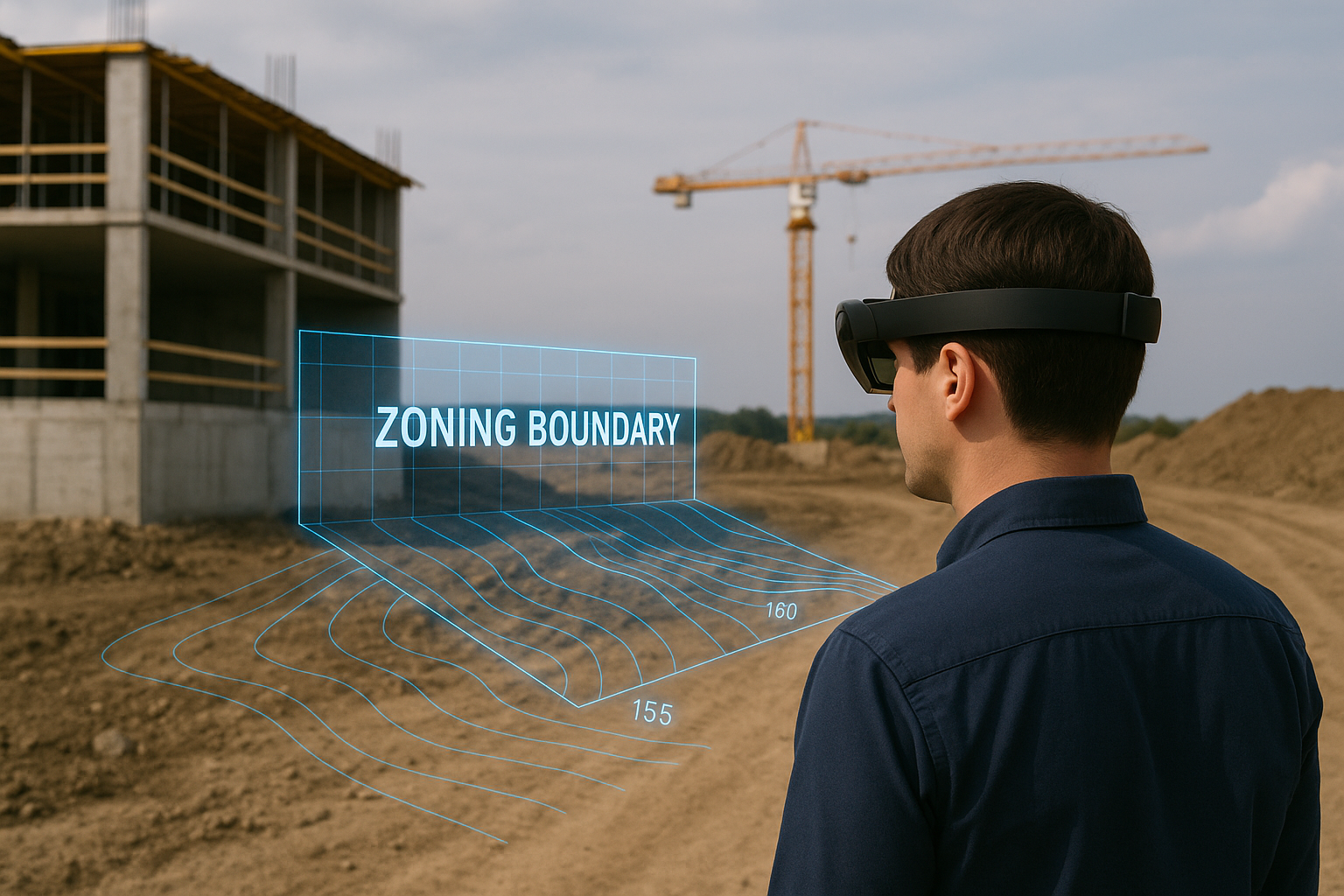
Visualizing Zoning Constraints with AR
Every site comes with unique zoning rules—setbacks, height restrictions, lot coverage, FAR (floor-area ratio), and more. AR lets you visualize these in full scale and in real time. Imagine walking the site and seeing a translucent overlay showing where you can or cannot build based on zoning setbacks.
This spatial clarity simplifies compliance and improves communication with city officials, clients, and stakeholders.
Analyzing Terrain and Topography with AR
With AR tools layered on geospatial data or LiDAR scans, architects can:
- Understand slope severity and how it affects grading
- Spot flood risk zones or erosion-prone areas
- Place building footprints on uneven terrain accurately
This minimizes excavation errors and leads to more environmentally sensitive designs.
Site Planning for Views, Orientation, and Sunlight
AR in site planning supports passive design by letting architects:
- Test building placement based on solar exposure
- Maximize views while minimizing glare or heat gain
- Experiment with different orientations on-site
What once took multiple 2D sketches or simulation reports now takes minutes with an AR walk-through.
Use Cases for AR in Site Analysis
Urban Infill Projects
In dense cities, small plots require strategic design. AR allows architects to test massing and height envelopes in tight spaces—ensuring compliance with shadow studies, sightlines, and fire code setbacks.
Large-Scale Campus and Master Plans
When working across multiple parcels or long timelines, AR helps stakeholders visualize phased developments, road alignments, or open space networks before committing to detailed plans.
Rural and Greenfield Sites
For unbuilt land, AR visualizations help demonstrate environmental impact, assess topography, and validate infrastructure feasibility in the field—even when Wi-Fi is unavailable (with offline AR modes).
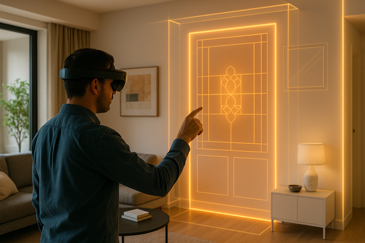
How AUGmentecture Supports AR in Site Planning
AUGmentecture lets teams upload 3D models from Revit, SketchUp, or Rhino and visualize them on-site at true scale. Features that support site analysis include:
- Markerless placement in large outdoor spaces
- Integration with GIS and terrain datasets
- Real-time model editing and layering
- Remote client walkthroughs of proposed buildings in situ
Even in early planning phases, this boosts communication and reduces rework during schematic design.
Case Study: AR for Mixed-Use Development Feasibility
An architecture team was hired to plan a mixed-use development on a sloped urban lot. Using AR, they:
- Identified that the original garage location would block ADA access
- Moved residential units to optimize for winter sun exposure
- Adjusted heights to comply with a hidden view corridor ordinance
All of this happened before formal zoning review—saving 6–8 weeks of rework and accelerating client approvals.
Future of AR in Site Analysis and Pre-Design
As regulations and site complexity grow, AR will evolve to integrate:
- AI-driven massing suggestions based on constraints
- Live permitting data updates during walkthroughs
- AR drone flyovers for larger or inaccessible sites
These tools will empower architects to design with deeper geographic intelligence from the start—not just artistic vision.
Conclusion
AR in site analysis closes the gap between planning and physical space. From zoning to terrain to orientation, it enables more accurate, responsive, and confident decisions. Architects can align vision with regulation, creativity with topography, and intent with execution.
Platforms like AUGmentecture are making this powerful capability available to teams of all sizes. The sooner you start using AR for site planning, the more value you unlock throughout the project lifecycle.